FOR TROPICAL NORTH ATLANTIC OCEAN, CARIBBEAN SEA, AND GULF OF MEXICO
AREA OF SPECIAL INTEREST: 10–20°N AND 40–65°W
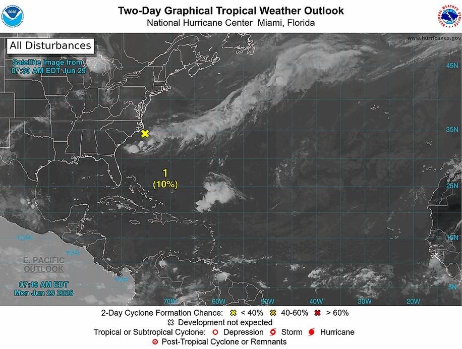
Disturbance 1 (Yellow x): Disorganised showers and thunderstorms located off the southeastern US coast are associated with an area of low pressure along a frontal boundary. Environmental conditions only appear marginally favourable for some tropical development over the next day or two as the system drifts southward and then westward before conditions become even less favourable later this week. Formation chance through 48 hours low 10%. Formation chance through 7 days low 10%.
Tropical Wave: A central Atlantic tropical wave has its axis along 58°W, south of 14°N, moving westward at 10-15 kt. Scattered moderate convection is found along the wave axis and N of 06°N. This wave is expected to traverse Grenada on Monday night into Tuesday, producing cloudy skies, light to moderate showers and possible thunderstorms.
Elsewhere, tropical cyclone activity is not expected during the next 48 hours.
The next update will be issued at 2 pm
Meteorological Services, MBIA
Grenada Airports Authority (GAA)
Continue Reading