The Runit Dome covers waste from the United States nuclear program in an open crater on Enewetak Atoll, while Marshall Islands residents demand answers about groundwater, sea level rise, environmental monitoring, and responsibility for the radioactive legacy
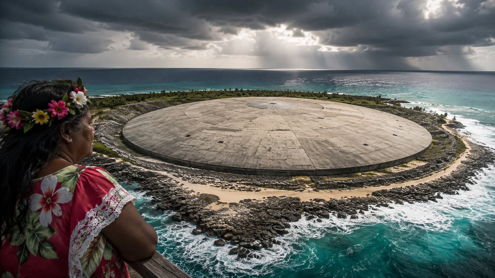
Seen from above, the Runit Dome looks like a huge concrete circle surrounded by the blue of the Pacific Ocean. Under this cover are more than 100,000 cubic yards of radioactive soil and debris, gathered inside a crater that was not lined at the bottom.
The structure was built in the late 1970s, on Runit Island, within the Enewetak Atoll, in the Marshall Islands. The information was released by the U.S. Department of Energy, a federal energy agency of the United States.
The structure functions as a protective cap against erosion, not as a completely impermeable container. This difference fuels local concerns about water circulation, rising sea levels, and the future of the waste left by the United States nuclear testing program.
The circular scar of the Runit Dome seen from above in the Pacific
The aerial photograph shows an almost perfect shape at the northern end of Runit Island. The concrete contrasts with the vegetation, the narrow beach, and the ocean, creating one of the most well-known images of the nuclear legacy in the Marshall Islands.
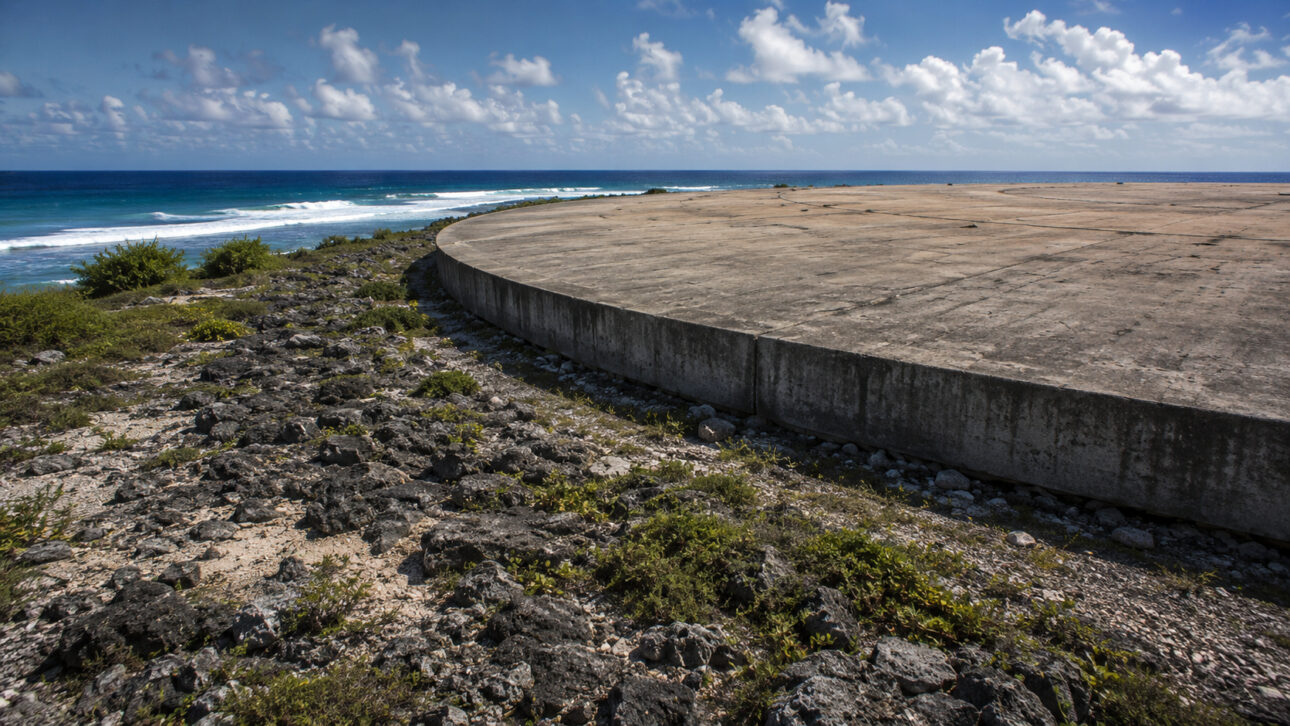
The circle covers the Cactus Crater, opened by a nuclear explosion conducted on Enewetak Atoll. The area was used during the cleanup process of the islands contaminated by tests conducted by the United States.
Residents of the atoll had been evacuated before the tests and returned to the region after the cleanup work. However, Runit Island remained uninhabited due to the existing contamination in the area.
What is under the concrete cap built at the end of the 1970s
During the cleanup, teams collected radioactive soil, pieces of concrete, metal structures, and other contaminated debris. Part of this material was mixed with cement and deposited inside the Cactus Crater.
The stored volume exceeds 100,000 cubic yards. Construction was completed in 1979, when the mass of waste was covered with large concrete panels.
The cap was designed to reduce wear caused by wind and water. It decreases the erosion of the waste pile, but does not turn the crater into a completely sealed box, isolated from the soil and groundwater.
Why the crater received concrete on top but did not get lining at the base
The Cactus Crater does not have an impermeable layer under the waste. In practice, the material was placed directly in an open nuclear crater on the ground and then covered with concrete on the top.
The public documentation from June 2020 does not provide a detailed justification for the absence of this lower lining. The described project prioritized mixing the waste with cement and installing a cover capable of reducing natural erosion.
Groundwater circulates under the structure and is influenced by the tides. This means that monitoring cannot be limited to visible cracks in the concrete, as it also needs to observe the water quality inside and around the crater.
Sea level rise raises doubts about erosion, waves, and groundwater
The rise in sea level concerns residents and authorities of the Marshall Islands because the islands are low and exposed to strong waves and flooding. At the Runit Dome, the most direct effect may come from the advance of waves over the structure and changes in groundwater movement.
U.S. Department of Energy, the federal energy agency of the United States, declared in June 2020 that the dome did not pose an immediate danger of collapse. Inspections found cracks and worn parts, but the cover still fulfilled its function of reducing erosion.
The agency also recorded that the available data did not show a measurable negative environmental impact caused by the dome’s waste at that time. This position does not eliminate the need for ongoing studies, especially since future behavior depends on tides, storms, and sea level rise.
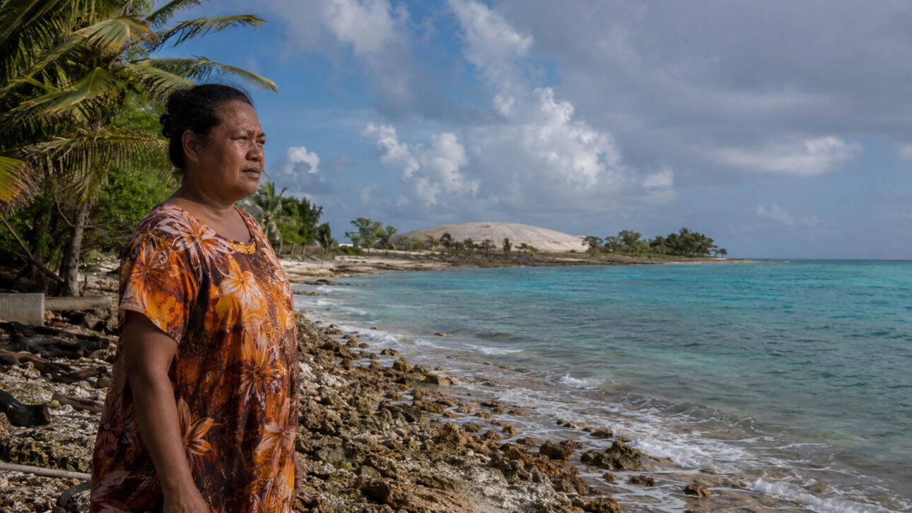
The GAO, the audit agency of the United States Congress, published on January 31, 2024 that local authorities remained concerned about the contaminated sites and the effects of sea level rise. The agency also identified difficulties in communicating risk assessments to the population.
United States Government and Marshall Islands Divide Tasks and Responsibilities
An agreement established after the independence of the Marshall Islands transferred to the local government control over the use of areas affected by nuclear tests. Later, new rules assigned the United States government periodic tasks of inspecting the cover and analyzing the groundwater.
This division creates a difficult situation for the residents. The territory is under the administration of the Marshall Islands, while the technical monitoring of a structure created to receive waste from the American nuclear program remains linked to the United States.
The discussion involves more than the condition of the concrete. It includes public trust, access to data, water protection, food safety, and responsibility for the nuclear legacy left on the Enewetak Atoll.
The Runit Dome continues to cover more than 100 thousand cubic yards of radioactive material inside a crater without a bottom lining. The structure reduces erosion but does not offer complete isolation between the waste, the ground, and the water circulating under the site.
The concrete circle remains a visible mark of the nuclear tests conducted in the Pacific. Official assessments rule out an immediate collapse, while residents of the Marshall Islands demand lasting monitoring, clear communication, and answers about the effects of sea level rise.
A cover that reduces erosion but does not completely isolate the waste, can it be considered sufficient in the face of sea level rise, or should the United States assume a broader solution?
Source link