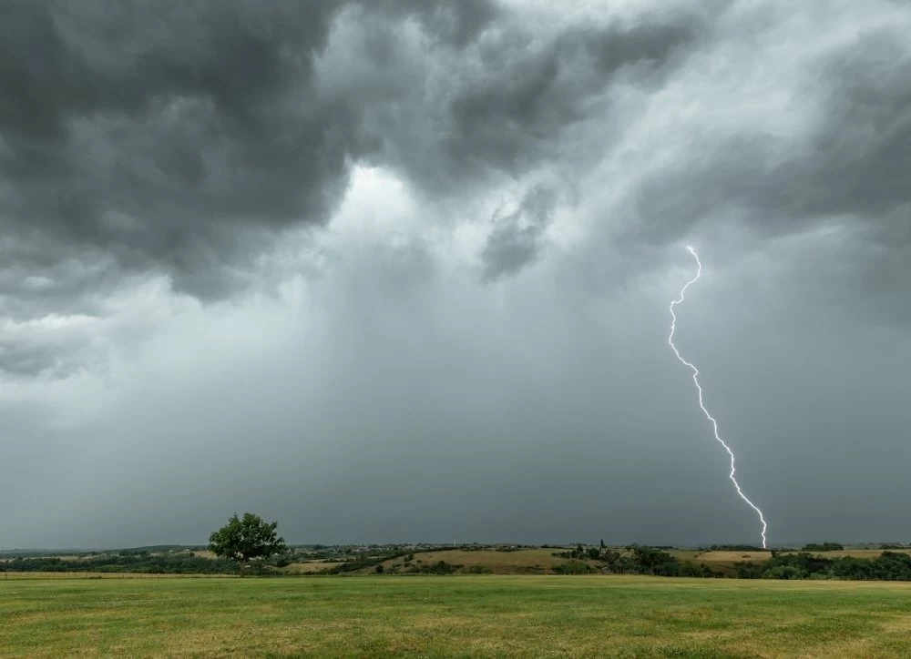
THE weather conditions in Morocco will remain agitated over the next few days, in a classic spring context marked by strong thermal contrasts. At this time of year, cold air in the upper layers of the atmosphere comes into contact with milder, more humid air near the ground. This thermal shock promotes the formation of storm clouds capable of producing heavy downpours in a short time.
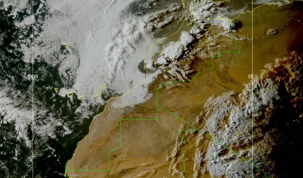
The satellite images recorded Monday evening also show the development of storm cells active on the peaks of the High Atlas and the surrounding plains. When the cloud tops reach very high altitudes, this reflects strong convective activity likely to cause hailpowerful gusts descendants and heavy rain over short periods of time.
In this context, caution remains recommended, particularly in mountainous and inland areas exposed to storms, due to the risk of rapid runoff, flash floods and reduced visibility during heavy downpours.
Wednesday, unstable clouds will persist over the Rif, the Middle Atlas and the north of the Oriental, with some showers possible. The sky will also sometimes be cloudy over the Mediterranean coast, the High Atlas and neighboring regions. The winds will still blow fairly steadily, particularly in the Middle Atlas and the Saharan provinces. Temperatures are expected to remain stable or increase slightly depending on the region.
From Thursday until the end of the week, the weather will remain variable with alternating clearings and cloudy passages on the northern and central plains, the Rif, the Mediterranean coast, the Atlas reliefs as well as the northern Saharan provinces. THE winds may strengthen at times, particularly in Tangier, the south-east, the Saharan provinces, the south of the Oriental and the central coasts. THE temperatures will experience little change immediately, before a gradual decline thereafter.
This sequence illustrates a typical situation of springmarked by rapid changes in weather between clearings, cloudy periods and localized stormy episodes.