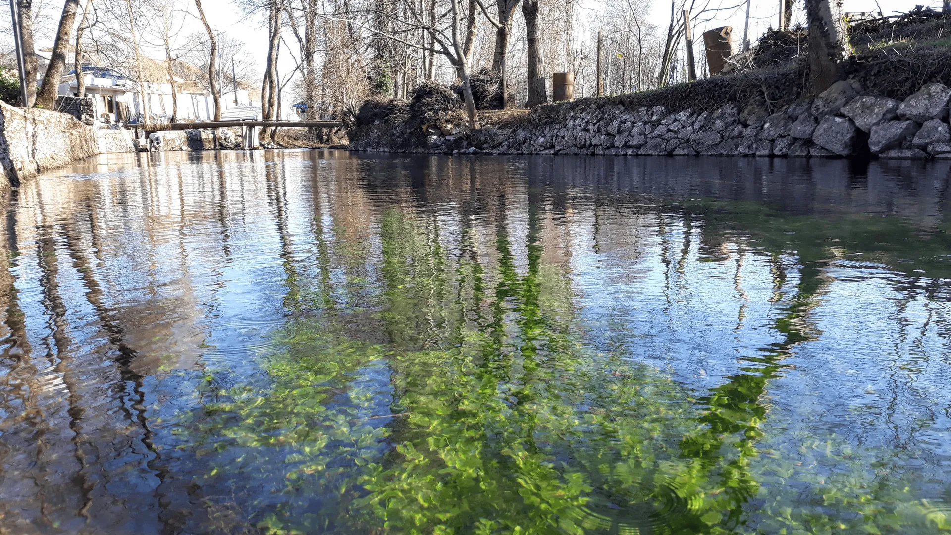
Bosnia and Herzegovina and Croatia share numerous natural phenomena, and among them the Vrljika river stands out, a karst sinkhole that flows through two countries, changes its name several times and springs from as many as five permanent sources.
This river originates in the Imotsko-Bekija field, where there are five sources – Vučja Draga, Jauk, Utopišće, Opačac and Dva oka (Jezerine). All are located on an area of about 500 meters. The largest among them is Opačac, while Dva oka is known for two almost perfectly round springs less than one meter apart. In addition to permanent springs, Vrljika is also filled with occasional springs Čečuk and Draga, which appear after heavy rainfall.
The river is 20 kilometers long, and its basin covers an area of 365 square kilometers. During its journey, it passes through Imotsko polje, and near the village of Zmijavci it gets a new name – Matica. At the edge of the Bekijsko polje, it sinks underground, after which it resurfaces in Bosnia and Herzegovina as Tihaljina in Peć Mlini, and later moves towards the Neretva under the name Trebižat.
Part of the Vrljika stream, from the source to the bridge on Perinuša, has been protected as a Special Ichthyological Reserve since 1971. Due to its isolation from other watercourses, numerous endemic species of fish live in the river. Among them, the soft-mouth trout stands out, one of the largest trout in the Adriatic basin. There are also Imotski gaovica, basak and macal, as well as pike, river crayfish and frogs.
In addition to rich animal life, the area is also home to numerous species of birds. During the winter, ducks and geese gather in the lower part of the river on their migration route to the sea, and species such as little grebe, hen, grebe and great and small woodpecker have also been recorded. Reeds, sedges, rushes, willows, apple trees, sage, St. John’s wort and rosemary grow on the banks.
Vrljika is considered a key source of life for the Imotski Krajina. The main source Opačac supplies water to about 98 percent of the population of the area, that is, approximately 30,000 people. According to the available data, it dried up only once, and that was for four hours after a very strong earthquake.
In addition to Vrljika, among the natural peculiarities of this region is Prološko blato, a protected wetland and floodplain in the west of the Imotski field. During the winter and spring, it is filled with water up to six meters deep, while in the warmer part of the year it recedes for the most part. In its westernmost part is Prološko Lake, whose depth reaches up to 35 meters.
On the northern shore of the lake is the Manastir hill, which turns into an island during high water levels. The remains of a Franciscan monastery are preserved on it, which represents an important part of the cultural heritage of the Imotska Krajina.