

Valid from: 6:00 AM on Sunday 05 July 2026
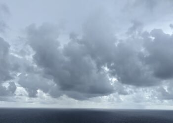
The Atlantic high-pressure system will maintain its dominance across the area during the next 24 hours resulting in an increase in wind speeds. Areas of moisture within the wind flow are expected to result in increased cloudiness with periods of light to moderate scattered showers mainly during the morning. Additionally, an increase in shower activity can be expected late tonight into tomorrow morning. People in areas prone to flooding, landslides and falling rocks are advised to be on alert and to exercise caution.
Moderate to poor air quality is forecast to continue throughout the week as a blanket of Saharan dust moves across the region. Persons who are sensitive to dust — particularly those with asthma, allergies, or other respiratory and skin conditions — should continue to take the necessary precautions. Mariners are advised to carry navigational devices, as visibility is likely to be low.
An increase in wave heights to near 5 feet along the western coast and 8 feet in open water along the eastern coast will be maintained today and a small craft advisory is in effect. Small craft operators and sea bathers should monitor conditions and exercise caution.