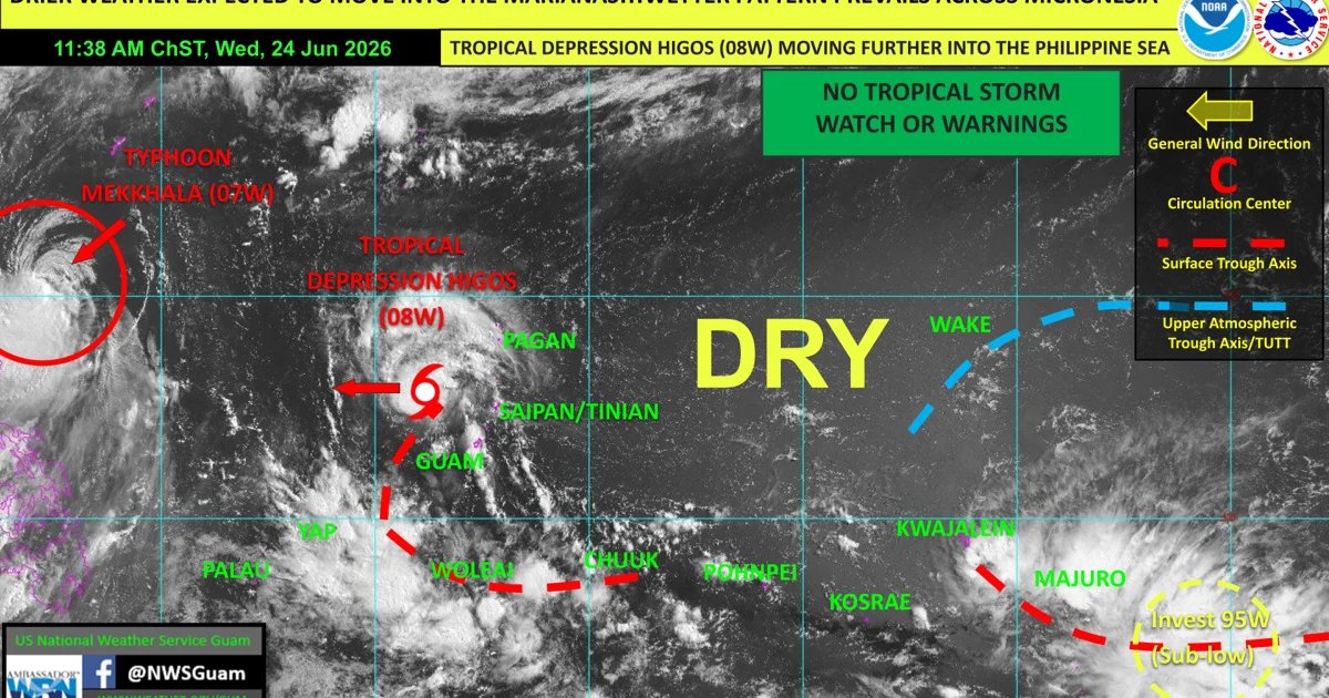
The National Weather Services expects “no further direct impacts” from Tropical Depression Higos as it moves away from the Marianas towards the Philippine Sea.
NWS said Wednesday morning that scattered showers and isolated thunderstorms will extend across the Marianas following Higos’s departure. Afterwards, the region can expect drier weather within the next one to two days.
Meanwhile, forecasters are tracking a new weather system, Invest 95W, east-southeast of the Marshall Islands.
The Joint Typhoon Warning Center opened Invest 95W, rating it as “sub-low” for development. This means that development into a tropical cyclone is unlikely over the next few days.
“Main impacts will be the potential for heavy rainfall in eastern Micronesia,” NWS said.
The current El Niño pattern shifts the area of tropical cyclone development eastward in the Western Pacific when compared to La Niña, forecasters said. “This region is being monitored for [tropical cyclone] potential over the next few weeks.”