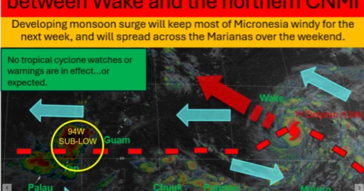
Typhoon Dolphin continues to move west to west-northwest, according to the National Weather Service in Tiyan on Wednesday.
NWS said Dolphin is expected to pass between Wake Island and the far northern Commonwealth of the Northern Mariana Islands and begin another period of rapid intensification that could reach 180 miles per hour by Friday.
They said the storm is not expected to affect any islands directly.
“The main effects for islands in Micronesia and the Marianas will be a westerly monsoon surge forecast to develop to the south and southwest of Dolphin,” NWS said. “Through Thursday night, this developing surge will affect all of Micronesia, first relinquishing control of the Marshall Islands on Friday, and Kosrae on Saturday.”
For the rest of Micronesia and the Marianas, the surge will remain in place until next week and combined seas are expected to increase between eight to 12 feet and fresh to strong winds, which will likely require a Small Craft Advisory.
Forecasters said to expect combined seas to reach 10 to 14 feet in the Marianas and winds could reach gale force speeds of 34 knots, again, producing hazardous to small craft.
A northeast swell from Dolphin will arrive Sunday, and early next week the Marianas can expect an increased west or southwest swell.
Forecasters said that the new sub-low tropical disturbance Invest 94W, located between Guam and Yap, will add to the winds and swells for western Micronesia.