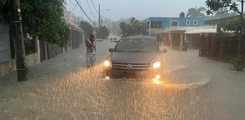
Meteorological authorities predict accumulated rainfall between 100 and 125 millimeters in the next 24 to 48 hours, due to the passage of a trough combined with a frontal system that will affect the weather conditions in the country.
This was stated this Friday by the director of the Dominican Institute of Meteorology (Indomet), Gloria Ceballosduring a press conference to alert the population about the rains expected this weekend.
“For the next 24 to 48 hours, the models show accumulated between 100 and 125 millimeters, with possible higher values in some isolated localities in the national territory,” said the specialist.
He indicated that for this Saturday, the proximity of the frontal system, in addition to the associated trough and the abundant humidity that the wind will be providing, especially from the northeast direction, the meteorological conditions will generate moderate to strong downpours with possible thunderstorms, possible hail and gusts of wind throughout the day.
These rainfalls are forecast for the Caribbean coast, including the Greater Santo Domingo.
At the same time it will extend over Monte Plata, Sánchez Ramírez, Duarte, Monsignor Noel, La Vega, Espaillat, Mirabal Sisters and demarcations of Cibao, the central mountain range, the border area and the southwest.
While on Sunday and Monday the frontal system is expected to park in the north of the country, in Atlantic waters.
“The moderate wind from the east-northeast will transport abundant humidity and the environment will continue to be quite unstable due to the incidence of the trough at various levels of the troposphere,” explained the director of Indomet.
He pointed out that these conditions will generate episodes of scattered rain during the morning towards the southeast, northeast and north, but they will intensify as the hours progress with downpours.
He confirmed that accumulated rainfall that could reach 250 millimeters is expected until Tuesday.
“By Wednesday it will not stop raining because there will still be instability, but the rains will move to the area of Puerto Rico, the Lesser Antilles, but little by little it will slowly move further east and then the situation will improve,” Ceballos explained.
Recommendations
Indomet urges the population to remain attentive to upcoming bulletins in the event of possible changes in the alert and warning levels, due to the risk of sudden floods, flooding of rivers, streams and ravines.