Even though it’s the southern hemisphere winter, this week we’ve been spending an inordinate amount of time peering north of the equator.
First a book review on the Island Hopper route through the northwestern Pacific, then a piece tracing the cold wake Super Typhoon Bavi left behind.
Short version: Bavi drew its energy from the warm ocean and dumped it into the atmosphere. When the ‘foon left the area, so did the warm water.
Impressive as that feat is, it’s not enough to stop the music in the most active cyclone basin on Earth.
Exactly a week after Bavi washed out on the east China coast, a disturbance was registered near the International Date Line – a genesis point typical of a strong El Niño. when warm water stretches far across the Pacific.
It was named Tropical Storm Dolphin on Monday and became a typhoon on Tuesday. On Wednesday, Typhoon Dolphin reached Category 4-equivalent strength. It is the third such system of the Pacific season, after Sinlaku in April and Bavi in early July.
Sea surface temperatures ahead of Dolphin are sitting at a scarcely believable 30-31 degrees, and the models are near-unanimous that Dolphin will reach Super Typhoon intensity (equivalent to a Category 5 cyclone) by tomorrow.
Some models have Dolphin’s central pressure dropping to 900 hPa, with winds approaching 300 km/h. Whatever the final numbers, Dolphin is tipped to hold Super Typhoon strength for an unusually long stretch as it passes over warm water with little upper atmosphere wind shear to trouble it.
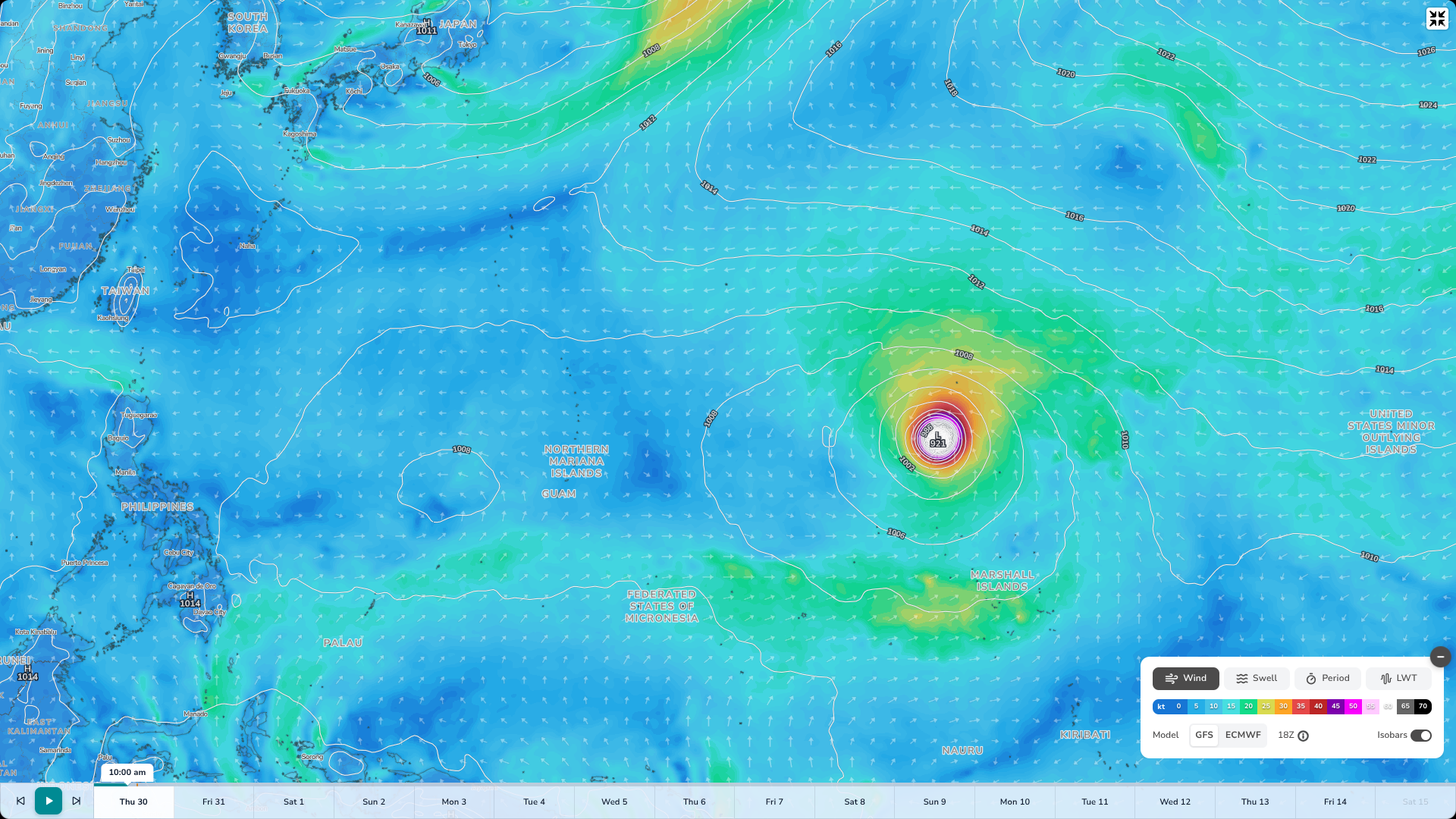
As of midday Thursday 30th July, Dolphin is passing north of the Marshall Islands on its way towards Asia. Central pressure currently 921 hPa. (Swellnet GFS 30/07/26)
Dolphin is forecast to track slightly north of Bavi’s path, offering relief for the people of the Northern Marianas who were ravaged by both Sinlaku and Bavi.
It’s presently moving west-northwest, riding the southern edge of a subtropical ridge. This path has it skirting the cold signal created by Bavi. Guidance suggests a more westerly track as it approaches Asia.
Though it’s a week out, both EC and GFS have Dolphin washing out as a tropical storm over Zheijang, eastern China – the same region Bavi also made landfall.
The bigger picture is the El Niño and the warm pool stretching from Central America to the central Pacific.. For a few days last week that swathe of warm water was hosting three tropical cyclones at once: Dolphin to the west, Fausto and Genevieve in the eastern/central Pacific, with Genevieve becoming Category 5.
All three were feeding off the same anomalously warm ocean. A clear example of tropical activity – and swell generation – during El Nino.
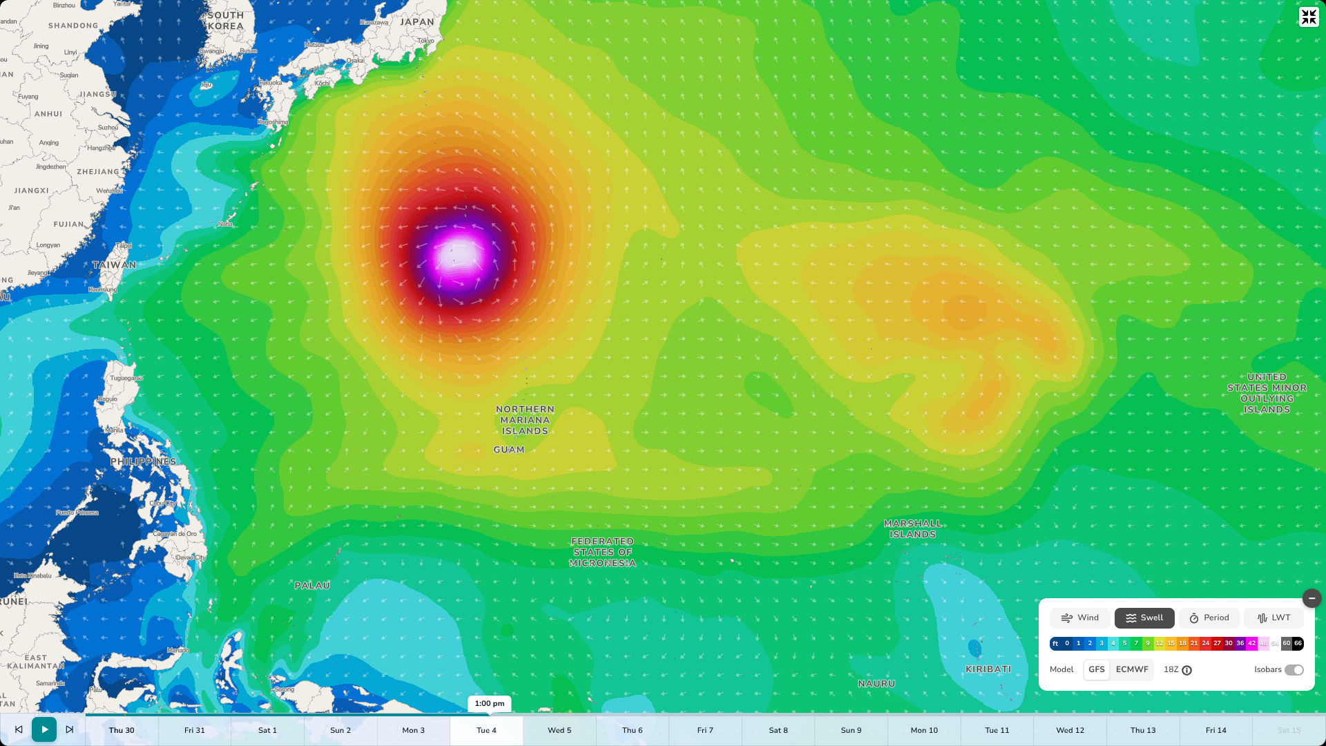
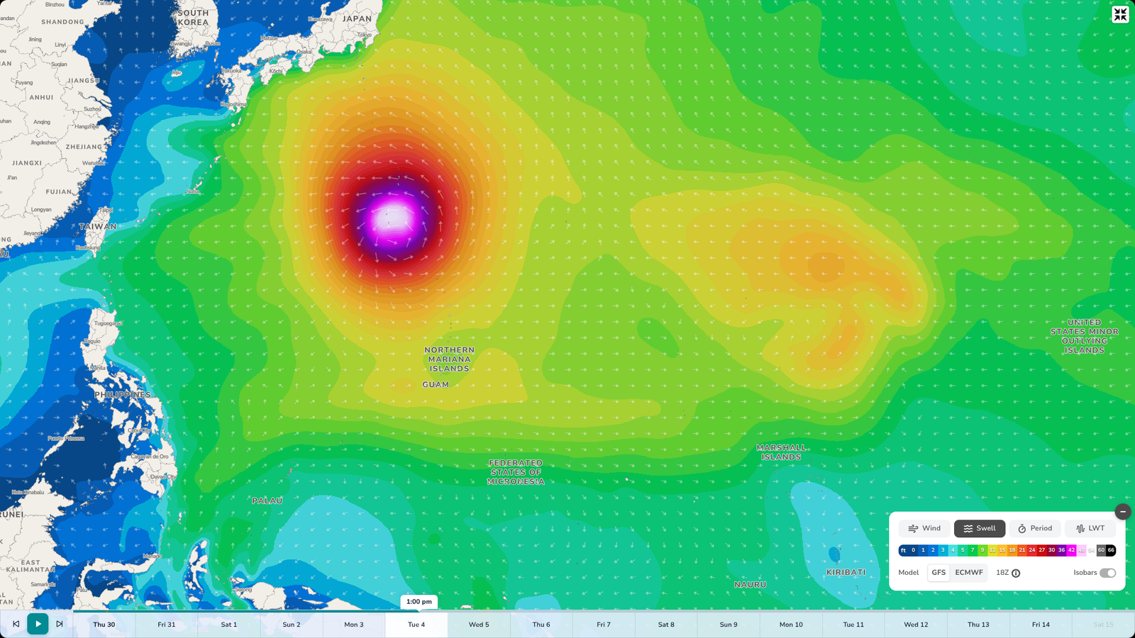
GFS modelling for next Tuesday showing swell radiating out from Super Typhoon Dolphin (Swellnet GFS 30/06/26)
For surfers, it’s worth noting the breadth of Typhoon Dolphin. It’s forecast to keep expanding as it intensifies, which typically means a broader fetch and hence a greater spread of swell energy reaching the coastlines bounding the west Pacific basin.