A low pressure system moving into Finland this weekend will bring snow, strong winds and disruption across southern and central regions, with authorities warning of poor driving conditions and potential damage.
The Finnish Meteorological Institute said the system will arrive from the northwest, with the first cloud bands reaching western parts of the country on Friday. Rain and snow will spread overnight into central areas before intensifying on Saturday.
The centre of the system is expected to track southeast along a line from Vaasa to Kotka. Areas south of this line will see lighter rainfall, mostly under five millimetres, while regions to the east and north face heavier precipitation.
In central and eastern Finland, snowfall and sleet will dominate. Forecasts indicate precipitation totals of 5 to 15 millimetres, with some eastern areas exceeding 20 millimetres. Snowfall could continue into Sunday, particularly in eastern regions.
Meteorologist Henri Nyman from the Finnish Meteorological Institute said conditions will deteriorate during the night. “Snowfall is expected to weaken driving conditions, especially during night hours from Central Ostrobothnia to South Karelia,” he said.
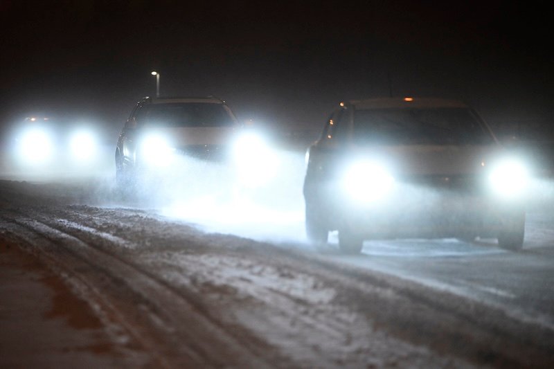
Driving conditions may become poor across wider parts of southern and central Finland for short periods. The Finnish Meteorological Institute said snowfall may be heavy at times, reducing visibility and making roads hazardous.
Wind will add to the impact. Northern and north-western winds will strengthen from Saturday afternoon, first along the western coast and later spreading inland. Gusts will increase through Saturday evening and intensify further on Sunday.
Forecasts show gusts reaching 15 to 20 metres per second across large areas. In open terrain and coastal zones, speeds may exceed 21 metres per second, with some southern areas seeing gusts up to 24 metres per second.
Meteorologist Eetu Rimo from the Finnish Meteorological Institute said the wind could cause damage. “Strong gusts may bring down trees and lead to power outages,” he said.
The combination of unfrozen ground and prolonged wind is expected to increase the risk of damage. Daytime solar heating may also strengthen gusts, according to forecasters.
By Sunday, the low pressure centre will move east of Finland. Snowfall will ease in western regions but continue in the east into the afternoon. Winds will remain strong in southern and central areas before gradually weakening later in the day.
Temperatures over the weekend will range between zero and eight degrees Celsius across most of the country. Southern and central areas will see slightly lower than average temperatures for the time of year.
The storm forms part of a broader shift to colder conditions, with cold air flowing south from the north. Snow and sleet may reach even southern coastal areas during the weekend.
Despite the return of winter conditions, forecasts suggest the cold period will be short. A monthly outlook from the European Centre for Medium-Range Weather Forecasts indicates temperatures may recover after early May.
Foreca Meteorologist Joonas Koskela said in the agency’s weather blog that conditions could shift later in the period. Warmer air may move into Finland around the May Day period, with temperatures potentially rising to between 10 and 15 degrees Celsius.
Longer term projections show temperatures turning above average later in May, with increased rainfall in some regions. However, forecasters noted that variability remains high and conditions may change.
For the coming days, officials have advised caution, particularly for road users. Snow, slush and strong winds are expected to create difficult travel conditions across affected regions.
HT