In Panama City, the location of the public institutions manifested itself early in the Old Town; around the square where religious power and the main civil institutions were concentrated. Another very clear example was the Balboa monumental complex with the Panama Canal Administration buildingwhich offers an example of how architecture, topography, landscape and visual axes They can be used to express institutionality and build a recognizable image of administrative power.
However, later, a good part of the government agencies ended up dispersing throughout the city, distributed among numerous buildings and sectors, without a clearly recognizable urban structure, through the adaptation or reuse of buildings whose location responded more to practical needs than to an overall urban vision. The plan of a new civic center for the city in the 21st century was outlined around the year 2014 when the national government commissioned the renowned international architecture and planning firm Skidmore, Owen and Merril a master plan for Albrook when the construction was just finished Line 1 of the Panama Metro.
A civic center It is not simply a group of public buildings. The government civic centers They have a historical tradition. These sets have brought together government offices, law courts, libraries, museums and other institutions, linking them with major transportation systems and public spaces. It is clear why so many cities have placed their government buildings around squareswhere large avenues frequently end in front of public buildings or monuments. Architects and urban planners They used large axes, monumental buildings, squares and gardens to express ideals of civic order and collective identity.
In it Government City plan of the year 2014 two great centralities stand out: the first is organized around a central squarenext to the Albrook train stationsurrounded by medium-rise buildings. This sector would be connected by a walkway with the National Transportation Terminal and an area dedicated to patios and workshops of the Panama Metro. The second centrality is presented as a space of character civic and monumentalsurrounded by fountains, reflecting pools, green areas and buildings arranged in a semicircle. Its public spaces maintained a direct connection with the shopping center Albrook Mall through a pedestrian walkway.
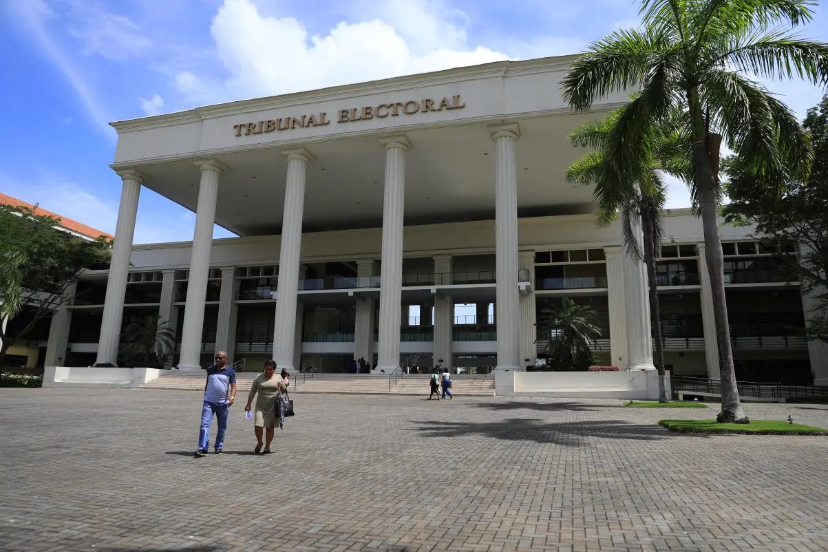
This composition occupied, among others, the current lands of the National Police and, together with the building of the Electoral Courtformed one of the main entrance accesses. In its vicinity the Curundu stationwhose presence would have reinforced the connection of the new government complex with the public transportation system and the urban residential sector of Curundu. He also took advantage of the edge of the Curundu River through a park, along the Ascanio Villalaz Avenuewith a succession of medium-height blocks, organized in small blocks with green patios.
This configuration proposed a pedestrian urban scaleas a succession of routes of public spaces, walkways and access to urban transport, in contrast to the large lots and facilities that currently characterize a good part of the sector. Regarding the profile of the buildings, they are of medium and low height, but fragmented and on a human scale that allowed the possibility of a certain architectural variety.
A new plan, on the same land, has been carried out by the Public Infrastructure Coordinating Unit (UCIP) of the Ministry of Public Works (MOP). According to the institutional description of the MOP, its functions include streamlining technical tasks related to the coordination, bidding, supervision and execution of contracts for the design, construction, equipment and maintenance of public infrastructure projects that are assigned by the Cabinet Council.
The proposal presented seems to rescue some of the road connections contemplated above in addition to an existing industrial structure for reconversion as commercial/retail use. The new district is organized mainly from macro applesrepresented on the plan by large areas of use over which future buildings would be distributed. It is closer to a traditional scheme of zoningin which functions are assigned, but without necessarily defining the urban form that these will produce. It is still to be defined how the buildings will relate to the streets, the heights and densities, the configuration between the facades and the ground floors, the relationship between the buildings and the public spaceand, above all, how pedestrians will move between the station, public institutions, commercial areas and surrounding neighborhoods. In an area served by the Metrothe priority should be to create a walkable, connected and less car-dependent district. He urban design It must explain how these uses, buildings, streets and public spaces are articulated to produce the city.
The possibility of creating in Albrook a new government centerit must be a place where architecture, routes, transportation and open spaces They allow institutions to be understandable and accessible to citizens. The uses that accompany the project will be equally important. One of the challenges is also how these spaces function at night, when they are single-use and become an empty place, without residents. Albrook offers the opportunity to incorporate cultural spaces, squares, gardens and a main civic promenade.
It is also about looking introspectively at what public spaces have traditionally worked in the city and reinterpret them according to the local climate and culture. Protection from sun and rain, shade, trees, covered corridors, ventilation and tropical landscapethe views and proximity to the Ancon hill should become essential elements of this new civic architecture. Through architecture, landscape and urban designthis project must convey the image of a centrality for the city.