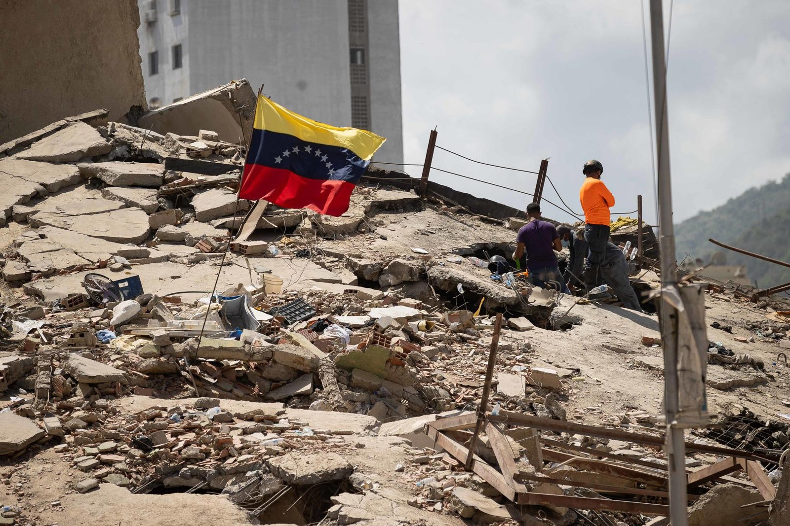
He double earthquake suffered in Venezuela It could have left some 58,870 buildings damaged or destroyed throughout the affected region, according to a first rapid experimental assessment carried out by NASA thanks to satellite images.
The images have been created using radar data from the Sentinel-1 satellite, which is part of the European Copernicus Earth observation program, and NASA highlights that it is a “preliminary product prepared a few days after the event and has not yet been validated.”
The data “estimates that approximately 58,870 buildings were likely damaged or destroyed across the affected region, based on the satellite’s last pass on June 25, 2026.
NASA’s Disaster Response Coordination System has been activated to provide support and is publishing additional maps and data products as they become available, the US space agency said on its social networks.
Experts analyzed two sets of data taken by Sentinel-1 radar technology after the event over the affected region, explains NASA’s Earthdata Geographic Information System (EGIS).
The first set of data was obtained on June 24 and covers the western area, close to the epicenter (around San Felipe and Yumare).
The second corresponds to June 25 and includes the metropolitan area of Caracas (including Petare and Antímano).
Each post-event image was compared to a series of pre-earthquake Sentinel-1 reference images captured over the previous year, and the two were merged into a single damage map.
The European Space Agency (ESA) is also using data from Sentinel-1 to create data maps, including one of the ground deformation due to the double quake, thanks to the satellite’s remote sensing instruments that can detect differences with millimeter precision.
The map is an interferogram obtained from the comparison of Sentinel-1 data corresponding to two dates: June 18, before the earthquakes, and June 25, a day after.
The image created thanks to the data shows the affected area, which extends from Caracas to the city of Puerto Cabello, about 210 kilometers west of the capital.
Venezuela suffered a double earthquake on Wednesday, June 24, 2026, with an epicenter near San Felipe and Yumare, in the center-north of the country, and with strong shaking along the central coast and in the metropolitan area of Caracas. The main earthquake, of magnitude 7.5, was preceded by a preliminary earthquake of 7.2, the EGIS recalled.