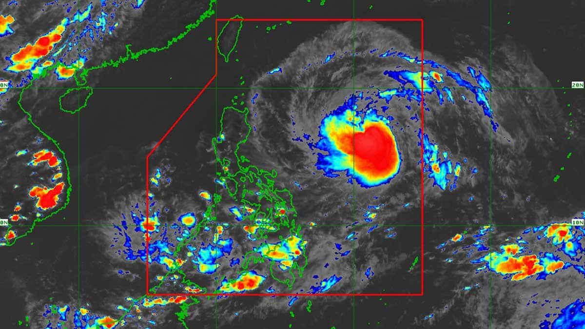

MANILA, Philippines — Francisco (international name: Mekkhala) intensified into a typhoon on Sunday afternoon, the state weather bureau said.
According to the Philippine Atmospheric, Geophysical and Astronomical Services Administration (Pagasa), Francisco became a typhoon around 2 p.m. while being monitored within the Philippine area of responsibility (PAR).
Its last recorded location was 820 kilometers (km) northeast of Eastern Visayas, based on Pagasa’s 5 p.m. bulletin.
It currently carries wind speeds of 120 km per hour (kph) and a gustiness of up to 150 kph while moving west-northwestward at 25 kph.
“Based on the latest forecast track, Wind Signal No. 1 may be hoisted in some localities in the northern and eastern portions of Cagayan, Babuyan Islands, and Batanes by tomorrow morning,” Pagasa said.
The state weather bureau also said Francisco is expected to remain over the Philippine Sea throughout the forecast period, though a closer approach to Extreme Northern Luzon is not entirely ruled out.
“Francisco will move west-northwestward until Wednesday (24 June), then it will decelerate as it recurves towards southern Japan for the rest of the forecast period,” it added.
Francisco is expected to further intensify, reaching its peak intensity by Tuesday, June 23.
Despite these developments, Pagasa noted that Francisco is “less likely to directly affect the weather conditions in the country” on Sunday.
Pagasa, however, warned that the onset of heavy rains caused by the enhanced southwest monsoon (habagat) may already begin on Monday, June 22.
The enhanced habagat may affect Northern Luzon and some areas in the western portions of Luzon and Visayas.
READ: Rainy Sunday due to habagat, trough of STS Francisco
Pagasa is monitoring another low-pressure area (LPA) outside the PAR, 3,030 km east of Southeastern Luzon.
The LPA currently has a “low” potential of developing into a tropical depression within the next day. /mcm /atm