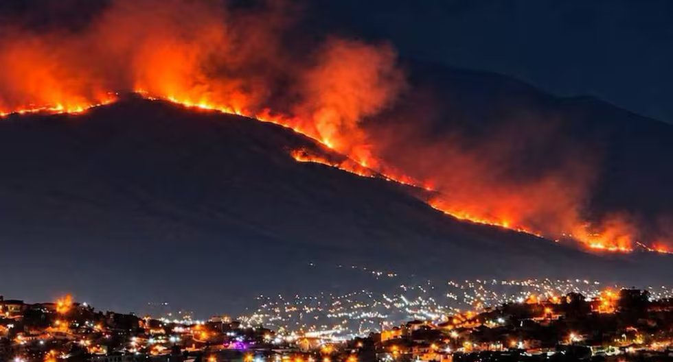
A forest fire of considerable magnitude is recorded on the slopes of the Chachani volcanoin Arequipa. Given the emergency, which occurred in the Cabrerías Association sector (Cayma district), the Regional Government of Arequipa coordinates immediate response actions with local authorities and first response institutions.
A forest fire of considerable magnitude is recorded on the slopes of the Chachani volcanoin Arequipa. Given the emergency, which occurred in the Cabrerías Association sector (Cayma district), the Regional Government of Arequipa coordinates immediate response actions with local authorities and first response institutions.
He fire that started at 10 in the morning is still active and destroyed 150 hectares of natural cover.
According to the regional authorities, the geographical characteristics of this area of Chachani make it difficult for brigades and specialized personnel to enter, which represents a significant limitation to carry out direct intervention tasks.

Forest fire on the slopes of the Chachani volcano. (Photo: Diffusion)
Faced with this scenario, inter-institutional coordination remains active with the objective of evaluating the behavior of the fire and define the most appropriate response actions according to the topographic conditions of the place.

Regional Government of Arequipa issues report on forest fire. Photo: GORE Arequipa
Finally, the Regional Government of Arequipa reiterated that it will continue with constant monitoring of the emergency and the coordination of operational efforts to strengthen the response capacity and protect the natural environment of the region.
He Chachani is located on the right side of Misti22 kilometers from the Plaza de Armas of the city of Arequipa. The coordinator of the OVI, Marcos Rivera, said that Chachani could wake up at any moment.
The OVI geologist, Rigoberto Aguilar, indicated that there are houses at least 10 km away. of the crater, on the domes (volcano flows that cooled). About 280 thousand people from various Human Settlements in the districts of Cayma, Cerro Colorado and Yura They live on high-risk terrain and don’t know it.
Therefore, they will also prepare the volcano hazard map so that the authorities can execute a territorial planning plan and not expose the population to danger.