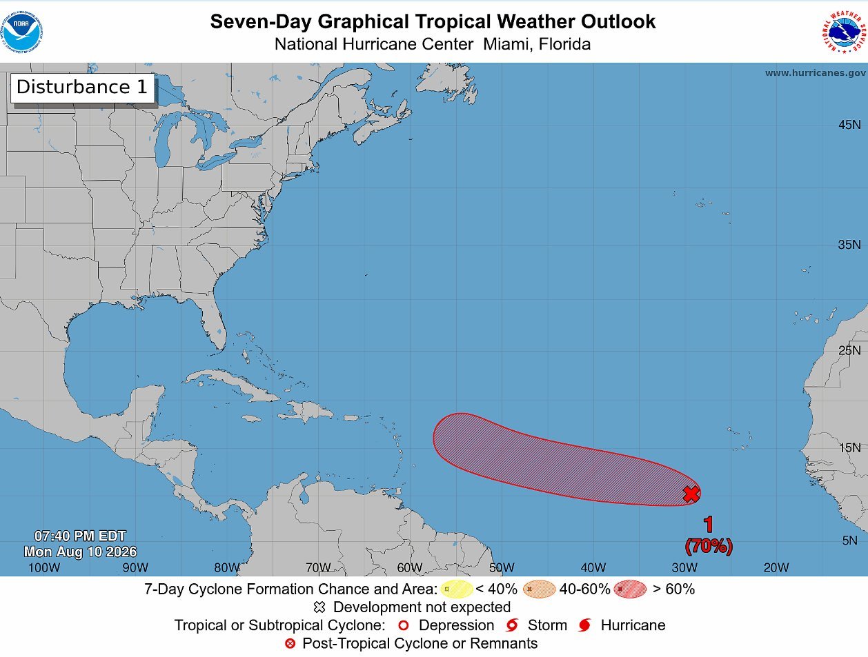


The National Hurricane Center is monitoring three disturbances across the Atlantic basin, including a strengthening system that now has a 70% chance of becoming a tropical cyclone within seven days.

In its 8 p.m. tropical weather outlook Monday, the NHC said an area of low pressure about 500 miles southwest of the Cabo Verde Islands was producing a large area of showers and thunderstorms.
Environmental conditions are forecast to become increasingly conducive to development during the next day or two. A tropical depression will likely form during the latter half of this week as the system moves west to west-northwest across the central tropical Atlantic.

The system has a 30% chance of formation within 48 hours and a high 70% chance over the next seven days.

Tropical Wave East of Windward Islands
The NHC is also tracking disorganized showers and thunderstorms associated with a tropical wave about 900 miles east of the Windward Islands.
Some gradual development is possible through midweek as the wave moves quickly westward across the central tropical Atlantic.

However, environmental conditions are expected to become less favorable later this week as the system approaches the Lesser Antilles.
Its chance of formation remains low at 10% through both 48 hours and seven days.
System Northeast of Bermuda
A third area under observation is a trough of low pressure located several hundred miles northeast of Bermuda.
The trough is producing a small area of showers and thunderstorms, and limited development is possible during the next couple of days as it moves quickly eastward across the central subtropical Atlantic.
The system is forecast to reach cooler waters later this week, ending its chances of tropical cyclone formation by Thursday.
It has a 10% chance of development through both 48 hours and seven days.
Advertise with the mоѕt vіѕіtеd nеwѕ ѕіtе іn Antigua!
We offer fully customizable and flexible digital marketing packages.
Contact us at [email protected]